Geolocate

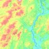
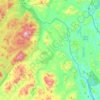
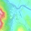
Brant Lake topographic map

Click on the map to display elevation.

About this map
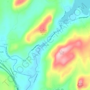
Name: Brant Lake topographic map, elevation, terrain.

Location: Brant Lake, Town of Horicon, Warren County, New York, 12815, United States (43.65651 -73.76956 43.69651 -73.72956)

Average elevation: 1,004 ft

Minimum elevation: 764 ft

Maximum elevation: 1,486 ft

Warren County trails, hiking, mountain biking, running and outdoor activities

Other topographic maps

Click on a map to view its topography, its elevation and its terrain.
Siamese Ponds Wilderness

United States > New York > Warren County

The topography consists of relatively low rolling hills with a few mountain summits like Bullhead, Eleventh, Puffer and South Pond Mountains above the 3,000 foot (914 m) level. In addition, the area contains a large number of beaver meadows and swamps. On most of the higher elevations, except those in severely…

Average elevation: 1,936 ft

Town of Stony Creek

United States > New York > Warren County

Average elevation: 1,437 ft

Town of Thurman

United States > New York > Warren County

Average elevation: 1,444 ft

Town of Johnsburg

United States > New York > Warren County

Average elevation: 1,506 ft

Town of Bolton

United States > New York > Warren County

Average elevation: 974 ft

Town of Horicon

United States > New York > Warren County

Average elevation: 1,112 ft

Pottersville

United States > New York > Warren County

Average elevation: 935 ft

Town of Hague

United States > New York > Warren County

Average elevation: 856 ft

Town of Johnsburg

United States > New York > Warren County

Average elevation: 1,506 ft

Town of Horicon

United States > New York > Warren County

Average elevation: 1,112 ft

Town of Stony Creek

United States > New York > Warren County

Average elevation: 1,437 ft

Town of Thurman

United States > New York > Warren County

Average elevation: 1,444 ft

Town of Hague

United States > New York > Warren County

Average elevation: 856 ft

Town of Horicon

United States > New York > Warren County

Average elevation: 1,112 ft

Town of Johnsburg

United States > New York > Warren County

Average elevation: 1,506 ft

Gear up for your next adventure:

🥤Water Filter Bottle - All‑in‑one filter bottle for safe hydration
🛠️Backpacking Tool Kit - Essential toolkit for outdoor repairs
🏫Relief Map Kits - Hands-on tools for teaching landforms and elevation
🦺Reflective Outdoor Gear - Safety gear for low‑light conditions
🧢Sun Protection Hats - Wide-brimmed and UPF-rated hats for high-altitude sun safety

As an Amazon Associate, this site earns from qualifying purchases at no extra cost to you.