Geolocate

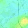
Kentstown topographic map

Click on the map to display elevation.

About this map

Name: Kentstown topographic map, elevation, terrain.

Location: Kentstown, The Municipal District of Ashbourne, County Meath, Leinster, Ireland (53.60720 -6.55279 53.64720 -6.51279)

Average elevation: 207 ft

Minimum elevation: 105 ft

Maximum elevation: 338 ft

Other topographic maps

Click on a map to view its topography, its elevation and its terrain.
Gear up for your next adventure:

🔦LED Headlamp - Bright and durable LED headlamp for night navigation
🧯Emergency Survival Kit - All‑in‑one survival essentials for the backcountry
🪑Ultralight Camp Chairs - Portable seating for resting after a long day of mapping
🗻Climbing Gear Basics - Essential gear for beginner climbers
🏕️Family Camping Gear - Essentials for group camping trips

As an Amazon Associate, this site earns from qualifying purchases at no extra cost to you.