Goreme topographic map
Click on the map to display elevation.
About this map
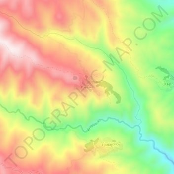
Name: Goreme topographic map, elevation, terrain.
Location: Goreme, Strumiani, Blagoevgrad, 2834, Bulgaria (41.62051 23.07193 41.66051 23.11193)
Average elevation: 2,428 ft
Minimum elevation: 1,414 ft
Maximum elevation: 3,310 ft
Other topographic maps
Click on a map to view its topography, its elevation and its terrain.

Bansko
Bansko lies at the foot of the Pirin Mountains, not far from the national park of the same name, in the valley of the Nestos River at an elevation of 925 meters above sea level. It is a ski resort. The city is about 160 km from Sofia and about 220 km from Thessaloniki.
Average elevation: 5,240 ft