
Thank you for supporting this site ❤️
Make a donation
Make a donation
Gear up for your next adventure:
As an Amazon Associate, this site earns from qualifying purchases at no extra cost to you.
l'Estany topographic map
Click on the map to display elevation.
Thank you for supporting this site ❤️
Make a donation
Make a donation
Gear up for your next adventure:
As an Amazon Associate, this site earns from qualifying purchases at no extra cost to you.
About this map
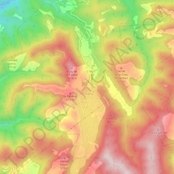
Name: l'Estany topographic map, elevation, terrain.
Location: l'Estany, Moianès, Barcelona, Catalonia, 08148, Spain (41.85385 2.08216 41.88944 2.13437)
Average elevation: 2,808 ft
Minimum elevation: 2,021 ft
Maximum elevation: 3,376 ft
Thank you for supporting this site ❤️
Make a donation
Make a donation
Gear up for your next adventure:
As an Amazon Associate, this site earns from qualifying purchases at no extra cost to you.