Geolocate

Ierissos topographic map

Click on the map to display elevation.

About this map
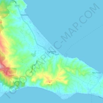
Name: Ierissos topographic map, elevation, terrain.

Location: Ierissos, Aristotle Municipality, Chalkidiki Regional Unit, Central Macedonia, Macedonia and Thrace, 630 75, Greece (40.35791 23.83762 40.43791 23.91762)

Average elevation: 118 ft

Minimum elevation: -7 ft

Maximum elevation: 938 ft

Gear up for your next adventure:

🔭Compact Binoculars - HD vision for scouting terrain and identifying distant landmarks
🎒Outdoor Daypacks - Lightweight backpacks designed for carrying maps and essential gear
🏥Hiking First Aid Kits - Comprehensive medical kits for remote trail injuries
🌡️Handheld Weather Meters - Measure wind, temp, and pressure for safe mountain travel
📚Navigation Handbooks - Master the art of reading topographic maps and using a compass

As an Amazon Associate, this site earns from qualifying purchases at no extra cost to you.