Geolocate

Kulang topographic map

Click on the map to display elevation.

About this map
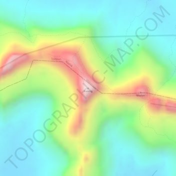
Name: Kulang topographic map, elevation, terrain.

Location: Kulang, Akola, Ahmednagar, Maharashtra, India (19.59021 73.64015 19.59031 73.64025)

Average elevation: 3,340 ft

Minimum elevation: 2,625 ft

Maximum elevation: 4,675 ft

Other topographic maps

Click on a map to view its topography, its elevation and its terrain.
Nizampur

India > Maharashtra > Akola

Average elevation: 919 ft

Gear up for your next adventure:

🪶Trail Camera - Capture wildlife on your hikes
🗺️Topographic Maps - Detailed topo maps for hiking, exploring and outdoor navigation
🪄Magnetic Compass - Accurate compass for navigation
🧺Microfiber Travel Towels - Compact and fast-drying towels for trail use
🧥Waterproof Jacket for Hiking - Breathable and rugged rain jacket for outdoor excursions

As an Amazon Associate, this site earns from qualifying purchases at no extra cost to you.