
Make a donation
Gear up for your next adventure:
As an Amazon Associate, this site earns from qualifying purchases at no extra cost to you.
Hortenkopf topographic map
Click on the map to display elevation.
Make a donation
Gear up for your next adventure:
As an Amazon Associate, this site earns from qualifying purchases at no extra cost to you.
Hortenkopf
Der Hortenkopf liegt im Naturpark Pfälzerwald und im Biosphärenreservat Pfälzerwald. Der Berg auf der Gemarkung von Merzalben ist der zweitsüdlichste einer Reihe von vier Gipfeln, die eine Höhe von über 600 m erreichen. Südlich, beim zur Gemeinde Wilgartswiesen gehörenden Weiler Hermersbergerhof, befindet sich der Weißenberg (609,9 m). Nach Norden folgen der Mosisberg (etwa 610 m) und der Eschkopf (608,3 m). Die beiden letztgenannten Berge liegen auf der Gemarkung des Weilers Hofstätten, der ebenfalls zu Wilgartswiesen gehört.
Make a donation
Gear up for your next adventure:
As an Amazon Associate, this site earns from qualifying purchases at no extra cost to you.
About this map
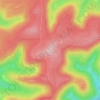
Name: Hortenkopf topographic map, elevation, terrain.
Average elevation: 1,650 ft
Minimum elevation: 1,056 ft
Maximum elevation: 1,975 ft
Make a donation
Gear up for your next adventure:
As an Amazon Associate, this site earns from qualifying purchases at no extra cost to you.