
Havré topographic map
Interactive map
Click on the map to display elevation.
About this map
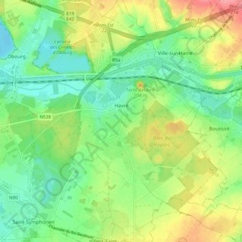
Name: Havré topographic map, elevation, terrain.
Location: Havré, Bergen, Henegouwen, Wallonië, 7021, België (50.43156 4.00293 50.48957 4.08510)
Average elevation: 200 ft
Minimum elevation: 95 ft
Maximum elevation: 377 ft
Other topographic maps
Click on a map to view its topography, its elevation and its terrain.
Hyon
België > Henegouwen > Bergen > Bergen
Hyon, Bergen, Henegouwen, Wallonië, 7022, België
Average elevation: 157 ft