Geolocate

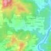
A Picada topographic map

Click on the map to display elevation.

About this map

Name: A Picada topographic map, elevation, terrain.

Location: A Picada, Salvaterra, Salvaterra de Miño, O Condado, Pontevedra, Galicia, 36450, España (42.06336 -8.50892 42.10336 -8.46892)

Average elevation: 174 ft

Minimum elevation: -7 ft

Maximum elevation: 492 ft

Other topographic maps

Click on a map to view its topography, its elevation and its terrain.
Alxén

España > Galicia > O Condado > Salvaterra de Miño

Average elevation: 233 ft

Arantei

España > Galicia > O Condado > Salvaterra de Miño

Average elevation: 171 ft

Gear up for your next adventure:

🚑Emergency Bivvies - Heat-reflective sleeping bags for survival situations
🖼️Topo Map Wall Art - Decorative topographic prints of famous peaks and regions
🪶Wildlife Field Guides - Learn animal tracking and species ID
📡GPS Antenna Upgrade - Enhance GPS reception in remote terrain
🎒Trail Energy Bars - High‑calorie bars for hiking energy

As an Amazon Associate, this site earns from qualifying purchases at no extra cost to you.