Geolocate

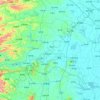
Mengquan topographic map

Click on the map to display elevation.

About this map

Name: Mengquan topographic map, elevation, terrain.

Location: Mengquan, Changde, Hunan, China (29.37495 111.43399 29.45495 111.51399)

Average elevation: 276 ft

Minimum elevation: 187 ft

Maximum elevation: 735 ft

Other topographic maps

Click on a map to view its topography, its elevation and its terrain.
Shimen County

China > Hunan > Changde

Average elevation: 1,335 ft

Li County

China > Hunan > Changde

Average elevation: 341 ft

Wuling District

China > Hunan > Changde

Average elevation: 171 ft

Gear up for your next adventure:

🧭Outdoor Navigation Book - Learn advanced navigation skills
🪵Folding Camp Saw - Compact saw for wood and campsite work
⛺Backpacking Tent - Lightweight and durable tent for multi‑day hikes
🎒Waterproof Dry Bags - Keep your electronics and maps dry inside your pack
🪶Fire Starter Kit - Reliable fire starter for survival and camping

As an Amazon Associate, this site earns from qualifying purchases at no extra cost to you.