
Thank you for supporting this site ❤️
Make a donation
Make a donation
Gear up for your next adventure:
As an Amazon Associate, this site earns from qualifying purchases at no extra cost to you.
Gandariças topographic map
Click on the map to display elevation.
Thank you for supporting this site ❤️
Make a donation
Make a donation
Gear up for your next adventure:
As an Amazon Associate, this site earns from qualifying purchases at no extra cost to you.
About this map
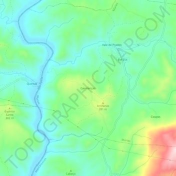
Name: Gandariças topographic map, elevation, terrain.
Location: Gandariças, Múrias, Mirandela, Distrito de Bragança, Portugal (41.57572 -7.16947 41.61572 -7.12947)
Average elevation: 1,030 ft
Minimum elevation: 751 ft
Maximum elevation: 1,752 ft
Thank you for supporting this site ❤️
Make a donation
Make a donation
Gear up for your next adventure:
As an Amazon Associate, this site earns from qualifying purchases at no extra cost to you.