
Thank you for supporting this site ❤️
Make a donation
Make a donation
Gear up for your next adventure:
As an Amazon Associate, this site earns from qualifying purchases at no extra cost to you.
Valbona topographic map
Click on the map to display elevation.
Thank you for supporting this site ❤️
Make a donation
Make a donation
Gear up for your next adventure:
As an Amazon Associate, this site earns from qualifying purchases at no extra cost to you.
About this map
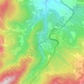
Name: Valbona topographic map, elevation, terrain.
Location: Valbona, Berceto, Parma, Emilia-Romagna, 43042, Italia (44.48205 9.92287 44.52205 9.96287)
Average elevation: 2,346 ft
Minimum elevation: 1,391 ft
Maximum elevation: 3,698 ft
Thank you for supporting this site ❤️
Make a donation
Make a donation
Gear up for your next adventure:
As an Amazon Associate, this site earns from qualifying purchases at no extra cost to you.