Geolocate

Muara Putih topographic map

Click on the map to display elevation.

About this map

Name: Muara Putih topographic map, elevation, terrain.

Location: Muara Putih, Lampung Selatan, Lampung, 35362, Indonesia (-5.31998 105.21431 -5.27998 105.25431)

Average elevation: 328 ft

Minimum elevation: 266 ft

Maximum elevation: 453 ft

Other topographic maps

Click on a map to view its topography, its elevation and its terrain.
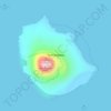
Anak Krakatau

Indonesia > Lampung > Lampung Selatan

Average elevation: 66 ft

Gear up for your next adventure:

🧷Carabiner Set - Durable clips for gear attachment
🛠️Backpacking Tool Kit - Essential toolkit for outdoor repairs
🪶Multi‑Purpose Knife - Useful blade for camp and trail
🌎3D Topographic Globes - Raised relief globes for a tactile understanding of geography
🔦LED Headlamp - Bright and durable LED headlamp for night navigation

As an Amazon Associate, this site earns from qualifying purchases at no extra cost to you.