Geolocate

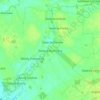
Brok topographic map

Click on the map to display elevation.

About this map

Name: Brok topographic map, elevation, terrain.

Location: Brok, gmina Brok, Ostrów Mazowiecka County, Masovian Voivodeship, Poland (52.67506 21.79236 52.72197 21.96827)

Average elevation: 344 ft

Minimum elevation: 299 ft

Maximum elevation: 420 ft

Other topographic maps

Click on a map to view its topography, its elevation and its terrain.
Gear up for your next adventure:

⛺Backpacking Tents - Weight-optimized shelters for multi-day topographic surveys
👖Convertible Hiking Pants - Versatile zip-off pants for changing altitudes and temperatures
🧴Hand Sanitizer - Keep hands clean while hiking
🧭Map Reading Tools - Tools and kits for map navigation
🛡️Bear Spray Outdoor - Protection in bear country hikes

As an Amazon Associate, this site earns from qualifying purchases at no extra cost to you.