
Fanwood topographic map
Click on the map to display elevation.
About this map
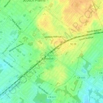
Name: Fanwood topographic map, elevation, terrain.
Location: Fanwood, Union County, New Jersey, 07023, United States (40.63045 -74.40208 40.65332 -74.37183)
Average elevation: 161 ft
Minimum elevation: 112 ft
Maximum elevation: 210 ft
Union County trails, hiking, mountain biking, running and outdoor activities
Other topographic maps
Click on a map to view its topography, its elevation and its terrain.
Crane Square
United States > New Jersey > Union County > Elizabeth > Crane Square
Average elevation: 33 ft
Watchung Reservation
United States > New Jersey > Union County > Mountainside
Average elevation: 387 ft