Geolocate

Saguing topographic map

Click on the map to display elevation.

About this map
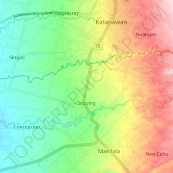
Name: Saguing topographic map, elevation, terrain.

Location: Saguing, Makilala, Cotabato, Soccsksargen, 9401, Philippines (6.96848 125.04744 6.99994 125.11525)

Average elevation: 778 ft

Minimum elevation: 449 ft

Maximum elevation: 1,247 ft

Gear up for your next adventure:

🧴Hand Sanitizer - Keep hands clean while hiking
🎒Hydration Pack - Hands‑free water reservoir for long hikes
🌡️Handheld Weather Meters - Measure wind, temp, and pressure for safe mountain travel
🥘Titanium Cookware - Durable, featherlight pots and pans for backpacking
🥄Camping Utensil Set - Lightweight utensils for outdoor meals

As an Amazon Associate, this site earns from qualifying purchases at no extra cost to you.