Geolocate

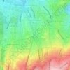
Ata Mahallesi topographic map

Click on the map to display elevation.

About this map

Name: Ata Mahallesi topographic map, elevation, terrain.

Location: Ata Mahallesi, Ankara, Çankaya, Ankara, Central Anatolia Region, Turkey (39.86974 32.82301 39.88316 32.82998)

Average elevation: 3,514 ft

Minimum elevation: 3,146 ft

Maximum elevation: 4,127 ft

Other topographic maps

Click on a map to view its topography, its elevation and its terrain.
Kuğulu Park

Turkey > Ankara > Çankaya

Average elevation: 3,159 ft

Adile Naşit Parkı

Turkey > Ankara > Çankaya

Average elevation: 3,169 ft

Gear up for your next adventure:

📦Gear Storage Bags - Organize and protect outdoor equipment
🥇GPS Hiking Watch - Multi‑sport GPS watch with navigation and trail tracking
🧭Hiking Compass - Precision compass for reliable navigation in the wilderness
🧣Hiking Neck Gaiter - Multi‑use neck protection for outdoor weather
🪶Wildlife Field Guides - Learn animal tracking and species ID

As an Amazon Associate, this site earns from qualifying purchases at no extra cost to you.