Geolocate

Lefkada topographic map

Click on the map to display elevation.

About this map

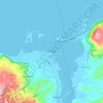
Name: Lefkada topographic map, elevation, terrain.

Location: Lefkada, Municipal Unit of Lefkada, Lefkada Municipality, Lefkada Regional Unit, Ioanian Islands, Peloponnese, Western Greece and the Ionian, 311 00, Greece (38.67526 20.54966 38.99526 20.86966)

Average elevation: 276 ft

Minimum elevation: -26 ft

Maximum elevation: 3,783 ft

Other topographic maps

Click on a map to view its topography, its elevation and its terrain.

Lefkada

Greece > Ioanian Islands > Lefkada Regional Unit

Average elevation: 364 ft

Gear up for your next adventure:

🪶Wildlife Field Guides - Learn animal tracking and species ID
📱Heavy-Duty Phone Cases - Drop-proof and waterproof protection for outdoor navigation
🪶Multi‑Purpose Knife - Useful blade for camp and trail
📦Dry Bags Set - Waterproof storage for electronics and clothes
🧤Tactile Hiking Gloves - Keep hands warm while operating GPS and smartphone screens

As an Amazon Associate, this site earns from qualifying purchases at no extra cost to you.