
Dummer topographic map
Click on the map to display elevation.
About this map
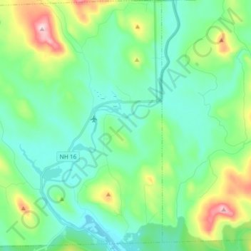
Name: Dummer topographic map, elevation, terrain.
Location: Dummer, Coös County, New Hampshire, United States (44.60344 -71.32669 44.70861 -71.17911)
Average elevation: 1,375 ft
Minimum elevation: 1,096 ft
Maximum elevation: 2,254 ft
Coos County trails, hiking, mountain biking, running and outdoor activities
Other topographic maps
Click on a map to view its topography, its elevation and its terrain.
Jefferson Highland
United States > New Hampshire > Coos County > Jefferson > Jefferson Highland
Average elevation: 1,480 ft
LIttle Diamond Pond
United States > New Hampshire > Coos County > Stewartstown
Average elevation: 2,274 ft
Wildcat Mountain
United States > New Hampshire > Coos County
Wildcat Mountain has five summits — A, B, C, D, and E — along Wildcat Ridge, which curves two miles (3 km) to the south and west. Both A, at 4,422 feet (1,348 m), and D, at 4,062 feet (1,238 m), are considered "four-thousand footers". B, with an elevation of 4,305 feet (1,312 m), and C, at 4,285 feet…
Average elevation: 3,461 ft
Pinkham Notch
United States > New Hampshire > Coos County
Pinkham Notch (elevation 2032 ft. / 619 m) is a mountain pass in the White Mountains of north-central New Hampshire, United States. The notch is a result of extensive erosion by the Laurentide Ice Sheet during the Wisconsinian ice age. Pinkham Notch was eroded into a glacial U-shaped valley whose walls are…
Average elevation: 2,516 ft