Geolocate

Monte do Facho topographic map

Click on the map to display elevation.

About this map

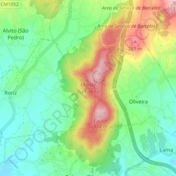
Name: Monte do Facho topographic map, elevation, terrain.

Location: Monte do Facho, Roriz, Barcelos, Braga, Portugal (41.56204 -8.58094 41.60914 -8.55013)

Average elevation: 397 ft

Minimum elevation: 79 ft

Maximum elevation: 1,024 ft

Gear up for your next adventure:

🥤Water Filter Bottle - All‑in‑one filter bottle for safe hydration
🪶Multi‑Purpose Knife - Useful blade for camp and trail
🛠️Backpacking Tool Kit - Essential toolkit for outdoor repairs
🥄Camping Utensil Set - Lightweight utensils for outdoor meals
🪶Camping Sleeping Pad - Comfortable sleeping pad for backpacking

As an Amazon Associate, this site earns from qualifying purchases at no extra cost to you.