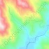
Algatocín topographic map
Click on the map to display elevation.
Algatocín
Algatocín is a town and municipality in the province of Málaga, part of the autonomous community of Andalusia in southern Spain. The municipality is situated approximately 143 kilometres (89 mi) from Málaga and 30 kilometres (19 mi) from Ronda. It is located in the west of the province in the Valle del Genal, being one of the towns that make up the comarca of the Serrania de Ronda. It is situated at an altitude of 725 metres (2,379 ft). The town has a population of approximately 900 residents, over a surface area of 20 square kilometres (7.7 sq mi), for a population density of 47 inhabitants per square kilometre (120/sq mi).
About this map

Name: Algatocín topographic map, elevation, terrain.
Location: Algatocín, Serranía de Ronda, Malaga, Andalusia, 29491, Spain (36.55878 -5.33077 36.59211 -5.24319)
Average elevation: 1,850 ft
Minimum elevation: 571 ft
Maximum elevation: 3,681 ft
Other topographic maps
Click on a map to view its topography, its elevation and its terrain.