Geolocate

Snowshill topographic map

Click on the map to display elevation.

About this map

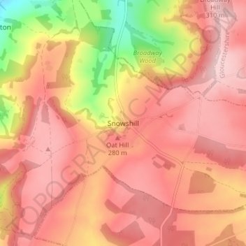
Name: Snowshill topographic map, elevation, terrain.

Location: Snowshill, Tewkesbury, Gloucestershire, England, WR12 7JX, United Kingdom (51.98213 -1.87980 52.02213 -1.83980)

Average elevation: 807 ft

Minimum elevation: 279 ft

Maximum elevation: 1,063 ft

Other topographic maps

Click on a map to view its topography, its elevation and its terrain.

Gear up for your next adventure:

🏕️Tent Footprint - Protect your tent base from wear
🥾Hiking Shoes - Durable and comfortable shoes for trail hiking
🥤Water Filter Bottle - All‑in‑one filter bottle for safe hydration
🧤Hiking Gloves - Protective gloves for rugged trails
🪑Ultralight Camp Chairs - Portable seating for resting after a long day of mapping

As an Amazon Associate, this site earns from qualifying purchases at no extra cost to you.