Geolocate

Punta Rocca topographic map

Click on the map to display elevation.

About this map

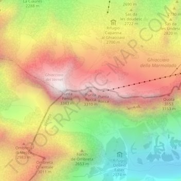
Name: Punta Rocca topographic map, elevation, terrain.

Location: Punta Rocca, Rocca Pietore, Belluno, Veneto, Italy (46.43433 11.85642 46.43443 11.85652)

Average elevation: 8,724 ft

Minimum elevation: 6,306 ft

Maximum elevation: 10,922 ft

Gear up for your next adventure:

GPS Sports Watch - GPS watch for running, hiking and training
Backpacking Tent - Lightweight and durable tent for multi‑day hikes
🎒Trekking Poles - Sturdy poles for balance and stability on rough terrain
Camping Coffee Makers - Enjoy premium coffee at the summit or campsite
📷Action Cameras - Rugged cameras to document your journeys across rugged terrain

As an Amazon Associate, this site earns from qualifying purchases at no extra cost to you.