Geolocate

Kaidi topographic map

Click on the map to display elevation.

About this map
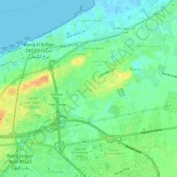
Name: Kaidi topographic map, elevation, terrain.

Location: Kaidi, Burj Al Kifan, Dar el-Beida District, Algiers, 16000, Algeria (36.71849 3.18496 36.75849 3.22496)

Average elevation: 43 ft

Minimum elevation: -7 ft

Maximum elevation: 115 ft

Other topographic maps

Click on a map to view its topography, its elevation and its terrain.

Gear up for your next adventure:

🧼Biodegradable Camping Soap - Eco‑friendly soap for outdoor hygiene
🔥Camping Stove - Portable stove for camping and backcountry cooking
🧭Hiking Compass - Precision compass for reliable navigation in the wilderness
🏥Hiking First Aid Kits - Comprehensive medical kits for remote trail injuries
📦Gear Storage Bags - Organize and protect outdoor equipment

As an Amazon Associate, this site earns from qualifying purchases at no extra cost to you.