
Town of Oakland topographic map
Interactive map
Click on the map to display elevation.
About this map
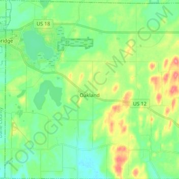
Name: Town of Oakland topographic map, elevation, terrain.
Location: Town of Oakland, Jefferson County, Wisconsin, United States (42.93492 -89.01310 43.02358 -88.89420)
Average elevation: 873 ft
Minimum elevation: 791 ft
Maximum elevation: 1,047 ft
Jefferson County trails, hiking, mountain biking, running and outdoor activities
Other topographic maps
Click on a map to view its topography, its elevation and its terrain.
Aztalan State Park
United States > Wisconsin > Jefferson County > Town of Aztalan
Average elevation: 837 ft