
Thank you for supporting this site ❤️
Make a donation
Make a donation
Gear up for your next adventure:
As an Amazon Associate, this site earns from qualifying purchases at no extra cost to you.
Taragoña topographic map
Click on the map to display elevation.
Thank you for supporting this site ❤️
Make a donation
Make a donation
Gear up for your next adventure:
As an Amazon Associate, this site earns from qualifying purchases at no extra cost to you.
About this map
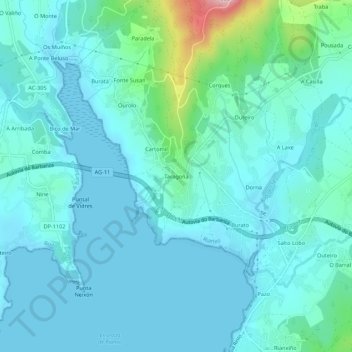
Name: Taragoña topographic map, elevation, terrain.
Location: Taragoña, Rianxo, Barbanza, La Coruña, Galicia, 15985, España (42.65401 -8.84576 42.69401 -8.80576)
Average elevation: 115 ft
Minimum elevation: 0 ft
Maximum elevation: 797 ft
Thank you for supporting this site ❤️
Make a donation
Make a donation
Gear up for your next adventure:
As an Amazon Associate, this site earns from qualifying purchases at no extra cost to you.