Geolocate

Jaora topographic map

Click on the map to display elevation.

About this map

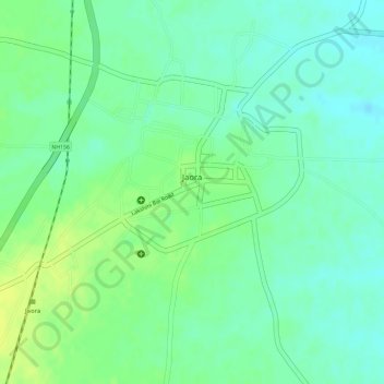
Name: Jaora topographic map, elevation, terrain.

Location: Jaora, Jaora Tahsil, Ratlam, Madhya Pradesh, India (23.62990 75.11918 23.64377 75.13578)

Average elevation: 1,542 ft

Minimum elevation: 1,509 ft

Maximum elevation: 1,575 ft

Gear up for your next adventure:

🛌Ultralight Sleeping Bags - Compact down bags for cold nights in the wilderness
🪶Survival Guide Book - Expert advice for emergency preparedness
🪶Trail Camera - Capture wildlife on your hikes
🧺Microfiber Travel Towels - Compact and fast-drying towels for trail use
🧥Men's Rain Shells - Premium waterproof and breathable jackets for mountain weather

As an Amazon Associate, this site earns from qualifying purchases at no extra cost to you.