
Gaylor topographic map
Click on the map to display elevation.
About this map
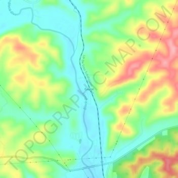
Name: Gaylor topographic map, elevation, terrain.
Location: Gaylor, Wayne County, Missouri, United States (37.07672 -90.73402 37.11672 -90.69402)
Average elevation: 564 ft
Minimum elevation: 420 ft
Maximum elevation: 787 ft
Wayne County trails, hiking, mountain biking, running and outdoor activities
Other topographic maps
Click on a map to view its topography, its elevation and its terrain.