
Parc Marie-Claire-Kirkland-Casgrain topographic map
Interactive map
Click on the map to display elevation.
About this map
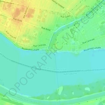
Name: Parc Marie-Claire-Kirkland-Casgrain topographic map, elevation, terrain.
Average elevation: 79 ft
Minimum elevation: 43 ft
Maximum elevation: 138 ft
Other topographic maps
Click on a map to view its topography, its elevation and its terrain.
Mount Royal Park
Canada > Quebec > Urban agglomeration of Montreal > Montreal
Mount Royal Park, Ville-Marie, Montreal, Urban agglomeration of Montreal, Montreal (administrative region), Quebec, H3G 1A8, Canada
Average elevation: 361 ft
Mount-Royal
Canada > Quebec > Urban agglomeration of Montreal > Montreal
Mount-Royal, Montreal, Urban agglomeration of Montreal, Montreal (06), Quebec, H3A 2B7, Canada
Average elevation: 364 ft
Parc-nature de la Pointe-aux-Prairies
Canada > Quebec > Urban agglomeration of Montreal > Montreal
Parc-nature de la Pointe-aux-Prairies, Rue Sherbrooke Est, Pointe-aux-Trembles, Montreal, Urban agglomeration of Montreal, Montreal (06), Quebec, H1A 3R1, Canada
Average elevation: 43 ft