
Mutare topographic map
Interactive map
Click on the map to display elevation.
About this map
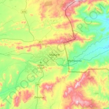
Name: Mutare topographic map, elevation, terrain.
Location: Mutare, Manicaland, Zimbabwe (-19.13466 32.51047 -18.81466 32.83047)
Average elevation: 3,806 ft
Minimum elevation: 2,359 ft
Maximum elevation: 6,230 ft
Other topographic maps
Click on a map to view its topography, its elevation and its terrain.