
Thank you for supporting this site ❤️
Make a donation
Make a donation
Gear up for your next adventure:
As an Amazon Associate, this site earns from qualifying purchases at no extra cost to you.
Monte la Pelosa topographic map
Click on the map to display elevation.
Thank you for supporting this site ❤️
Make a donation
Make a donation
Gear up for your next adventure:
As an Amazon Associate, this site earns from qualifying purchases at no extra cost to you.
About this map
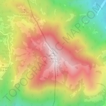
Name: Monte la Pelosa topographic map, elevation, terrain.
Location: Monte la Pelosa, Polino, Terni, Umbria, 05030, Italia (42.57939 12.89314 42.57949 12.89324)
Average elevation: 4,236 ft
Minimum elevation: 2,940 ft
Maximum elevation: 5,344 ft
Thank you for supporting this site ❤️
Make a donation
Make a donation
Gear up for your next adventure:
As an Amazon Associate, this site earns from qualifying purchases at no extra cost to you.