

Xichang topographic map
Click on the map to display elevation.
Xichang
Owing to its low latitude and high elevation, Xichang has a monsoon-influenced humid subtropical climate (Köppen Cwa) milder and far sunnier than the Sichuan Basin, with mild, very sunny and dry winters, and very warm, rainy summers. The monthly 24-hour average temperature ranges from 9.9 °C (49.8 °F) in January to 22.6 °C (72.7 °F) in July, and the annual mean is 17.15 °C (62.9 °F). Over 60% of the 1,025 mm (40.4 in) annual precipitation occurs from June to August. With monthly percent possible sunshine ranging from 36% in September to 72% in January, the city receives 2,367 hours of bright sunshine annually.
About this map
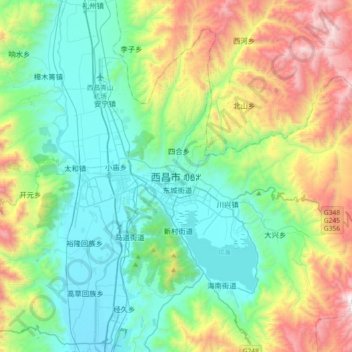
Name: Xichang topographic map, elevation, terrain.
Average elevation: 6,463 ft
Minimum elevation: 4,849 ft
Maximum elevation: 10,656 ft