
Thank you for supporting this site ❤️
Make a donation
Make a donation
Gear up for your next adventure:
As an Amazon Associate, this site earns from qualifying purchases at no extra cost to you.
Chivhu topographic map
Click on the map to display elevation.
Thank you for supporting this site ❤️
Make a donation
Make a donation
Gear up for your next adventure:
As an Amazon Associate, this site earns from qualifying purchases at no extra cost to you.
About this map
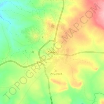
Name: Chivhu topographic map, elevation, terrain.
Location: Chivhu, Chikomba, Mashonaland East Province, Zimbabwe (-19.05870 30.85695 -18.97870 30.93695)
Average elevation: 4,747 ft
Minimum elevation: 4,560 ft
Maximum elevation: 4,970 ft
Thank you for supporting this site ❤️
Make a donation
Make a donation
Gear up for your next adventure:
As an Amazon Associate, this site earns from qualifying purchases at no extra cost to you.