
Thank you for supporting this site ❤️
Make a donation
Make a donation
Gear up for your next adventure:
As an Amazon Associate, this site earns from qualifying purchases at no extra cost to you.
Ortolano topographic map
Click on the map to display elevation.
Thank you for supporting this site ❤️
Make a donation
Make a donation
Gear up for your next adventure:
As an Amazon Associate, this site earns from qualifying purchases at no extra cost to you.
About this map
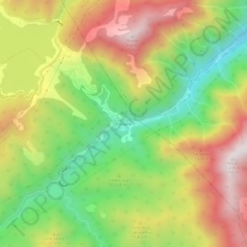
Name: Ortolano topographic map, elevation, terrain.
Location: Ortolano, Campotosto, L'Aquila, Abruzzo, Italia (42.49924 13.40428 42.53924 13.44428)
Average elevation: 4,206 ft
Minimum elevation: 2,864 ft
Maximum elevation: 5,679 ft
Thank you for supporting this site ❤️
Make a donation
Make a donation
Gear up for your next adventure:
As an Amazon Associate, this site earns from qualifying purchases at no extra cost to you.