Geolocate

Friendswood topographic map

Click on the map to display elevation.

About this map

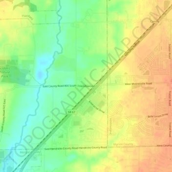
Name: Friendswood topographic map, elevation, terrain.

Location: Friendswood, Hendricks County, Indiana, 46113, United States (39.62643 -86.35277 39.66643 -86.31277)

Average elevation: 741 ft

Minimum elevation: 663 ft

Maximum elevation: 810 ft

Hendricks County trails, hiking, mountain biking, running and outdoor activities

Other topographic maps

Click on a map to view its topography, its elevation and its terrain.

North Salem

United States > Indiana > Hendricks County

Average elevation: 912 ft

Stilesville

United States > Indiana > Hendricks County

Average elevation: 787 ft

Coatesville

United States > Indiana > Hendricks County

Average elevation: 889 ft

Pittsboro

United States > Indiana > Hendricks County

Average elevation: 935 ft

Amo

United States > Indiana > Hendricks County

Average elevation: 837 ft

Avon

United States > Indiana > Hendricks County

Average elevation: 833 ft

Danville

United States > Indiana > Hendricks County

Average elevation: 922 ft

Clayton

United States > Indiana > Hendricks County

Average elevation: 863 ft

Lizton

United States > Indiana > Hendricks County

Average elevation: 958 ft

Gear up for your next adventure:

🪶Paracord Bracelet - Survival bracelet with built‑in tools
Backpacking Tents - Weight-optimized shelters for multi-day topographic surveys
🪶Survival Guide Book - Expert advice for emergency preparedness
🧭Outdoor Navigation Book - Learn advanced navigation skills
🚗GPS Dash Cams - Record your scenic drives through mountain passes and canyons

As an Amazon Associate, this site earns from qualifying purchases at no extra cost to you.