
Thank you for supporting this site ❤️
Make a donation
Make a donation
Gear up for your next adventure:
As an Amazon Associate, this site earns from qualifying purchases at no extra cost to you.
Dhawas topographic map
Click on the map to display elevation.
Thank you for supporting this site ❤️
Make a donation
Make a donation
Gear up for your next adventure:
As an Amazon Associate, this site earns from qualifying purchases at no extra cost to you.
About this map
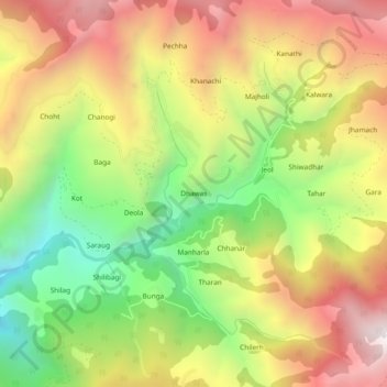
Name: Dhawas topographic map, elevation, terrain.
Location: Dhawas, Thunag, Mandi District, Himachal Pradesh, India (31.59028 77.19279 31.63028 77.23279)
Average elevation: 7,887 ft
Minimum elevation: 5,686 ft
Maximum elevation: 10,098 ft
Thank you for supporting this site ❤️
Make a donation
Make a donation
Gear up for your next adventure:
As an Amazon Associate, this site earns from qualifying purchases at no extra cost to you.