
新卡乡 topographic map
Interactive map
Click on the map to display elevation.
About this map
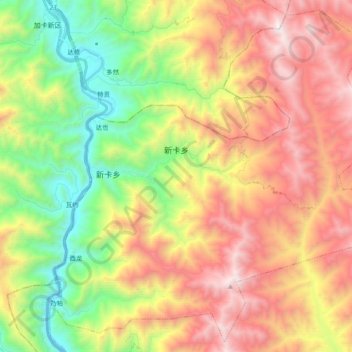
Name: 新卡乡 topographic map, elevation, terrain.
Location: 新卡乡, 察雅县, 昌都市, 西藏自治区, 中国 (30.82729 97.33849 30.98142 97.52874)
Average elevation: 13,104 ft
Minimum elevation: 10,220 ft
Maximum elevation: 16,398 ft
Other topographic maps
Click on a map to view its topography, its elevation and its terrain.