Geolocate

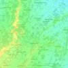
Verucchia topographic map

Click on the map to display elevation.

About this map

Name: Verucchia topographic map, elevation, terrain.

Location: Verucchia, Zocca, Unione di comuni Terre di Castelli, Modena, Emilia-Romagna, 41059, Italia (44.31300 10.96930 44.35300 11.00930)

Average elevation: 2,365 ft

Minimum elevation: 1,335 ft

Maximum elevation: 2,854 ft

Other topographic maps

Click on a map to view its topography, its elevation and its terrain.

Nonantola

Italia > Emilia-Romagna > Modena

Average elevation: 82 ft

Bomporto

Italia > Emilia-Romagna > Modena

Average elevation: 72 ft

Campogalliano

Italia > Emilia-Romagna > Modena

Average elevation: 121 ft

Cavezzo

Italia > Emilia-Romagna > Modena

Average elevation: 69 ft

Spilamberto

Italia > Emilia-Romagna > Modena

Average elevation: 210 ft

Tiepido

Italia > Emilia-Romagna > Modena

Average elevation: 643 ft

Saltino

Italia > Emilia-Romagna > Modena > Prignano sulla Secchia

Average elevation: 1,434 ft

San Damaso

Italia > Emilia-Romagna > Modena > Modena

Average elevation: 128 ft

Gear up for your next adventure:

🧤Tactile Hiking Gloves - Keep hands warm while operating GPS and smartphone screens
🪶Camp Gear Gift Set - Perfect gift bundle for outdoor fans
🥇GPS Hiking Watch - Multi‑sport GPS watch with navigation and trail tracking
🪑Portable Camp Table - Compact table for campsite meals
🔭Compact Binoculars - HD vision for scouting terrain and identifying distant landmarks

As an Amazon Associate, this site earns from qualifying purchases at no extra cost to you.