
Thank you for supporting this site ❤️
Make a donation
Make a donation
Gear up for your next adventure:
As an Amazon Associate, this site earns from qualifying purchases at no extra cost to you.
Travers topographic map
Click on the map to display elevation.
Thank you for supporting this site ❤️
Make a donation
Make a donation
Gear up for your next adventure:
As an Amazon Associate, this site earns from qualifying purchases at no extra cost to you.
About this map
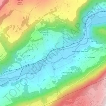
Name: Travers topographic map, elevation, terrain.
Location: Travers, Val-de-Travers, Neuchâtel, 2105, Suisse (46.92133 6.65636 46.96133 6.69636)
Average elevation: 3,041 ft
Minimum elevation: 2,365 ft
Maximum elevation: 4,364 ft
Thank you for supporting this site ❤️
Make a donation
Make a donation
Gear up for your next adventure:
As an Amazon Associate, this site earns from qualifying purchases at no extra cost to you.