
Make a donation
Gear up for your next adventure:
As an Amazon Associate, this site earns from qualifying purchases at no extra cost to you.
Quiroga topographic map
Click on the map to display elevation.
Make a donation
Gear up for your next adventure:
As an Amazon Associate, this site earns from qualifying purchases at no extra cost to you.
Quiroga
Quiroga es una población del norte del estado mexicano de Michoacán, cabecera municipal del municipio homónimo. Se encuentra a una distancia de 45 km de la capital del estado, en la ubicación 19°39′50″N 101°31′30″O / 19.66389, -101.52500, a una altitud de 2076 m s. n. m.
Make a donation
Gear up for your next adventure:
As an Amazon Associate, this site earns from qualifying purchases at no extra cost to you.
About this map
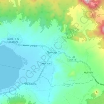
Name: Quiroga topographic map, elevation, terrain.
Location: Quiroga, Michoacán, 58420, México (19.62381 -101.56403 19.70381 -101.48403)
Average elevation: 7,224 ft
Minimum elevation: 6,680 ft
Maximum elevation: 9,147 ft
Make a donation
Gear up for your next adventure:
As an Amazon Associate, this site earns from qualifying purchases at no extra cost to you.