
下关 topographic map
Interactive map
Click on the map to display elevation.
About this map
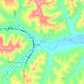
Name: 下关 topographic map, elevation, terrain.
Location: 下关, 华亭市, 平凉市, 甘肃省, 中国 (35.10327 106.73324 35.14327 106.77324)
Average elevation: 4,596 ft
Minimum elevation: 4,341 ft
Maximum elevation: 5,007 ft
Other topographic maps
Click on a map to view its topography, its elevation and its terrain.