
清水河镇 topographic map
Interactive map
Click on the map to display elevation.
About this map
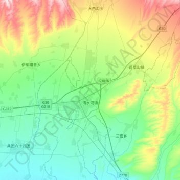
Name: 清水河镇 topographic map, elevation, terrain.
Location: 清水河镇, 霍城县, 伊犁哈萨克自治州, 新疆维吾尔自治区, 中国 (44.07770 80.65400 44.32948 80.95574)
Average elevation: 2,556 ft
Minimum elevation: 2,031 ft
Maximum elevation: 3,871 ft
Other topographic maps
Click on a map to view its topography, its elevation and its terrain.