
Make a donation
Gear up for your next adventure:
As an Amazon Associate, this site earns from qualifying purchases at no extra cost to you.
Gränna topographic map
Click on the map to display elevation.
Make a donation
Gear up for your next adventure:
As an Amazon Associate, this site earns from qualifying purchases at no extra cost to you.
About this map
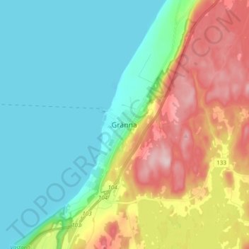
Name: Gränna topographic map, elevation, terrain.
Location: Gränna, Jönköpings kommun, 563 31, Sweden (57.98506 14.42731 58.06506 14.50731)
Average elevation: 538 ft
Minimum elevation: 282 ft
Maximum elevation: 1,063 ft
Make a donation
Gear up for your next adventure:
As an Amazon Associate, this site earns from qualifying purchases at no extra cost to you.
Other topographic maps
Click on a map to view its topography, its elevation and its terrain.
Make a donation
Gear up for your next adventure:
As an Amazon Associate, this site earns from qualifying purchases at no extra cost to you.
Kullaberg
Sweden > Skåne County > Mölle
Kullaberg (Swedish pronunciation: [kɵlaˈbærj]) is a peninsula and nature reserve of land protruding into the Kattegat in Höganäs Municipality near the town of Mölle in southwest Sweden. The site in the province of Skåne is an area of considerable biodiversity supporting a number of rare species and has…
Average elevation: 72 ft
Make a donation
Gear up for your next adventure:
As an Amazon Associate, this site earns from qualifying purchases at no extra cost to you.
Ven
Along the entire coast, the island drops steeply towards the sea where the Öresund meets a rocky beach. This steep coast is called Backafall. Ven's backafall is a nature reserve established in 1990. There are no large forests, but smaller stands of trees occur closest to the coast the slightly higher…
Average elevation: 43 ft
Make a donation
Gear up for your next adventure:
As an Amazon Associate, this site earns from qualifying purchases at no extra cost to you.
Make a donation
Gear up for your next adventure:
As an Amazon Associate, this site earns from qualifying purchases at no extra cost to you.
Torneträsk
Permafrost is common in the land around the lake. This low elevation permafrost is disappearing because of global warming and increased snowfall.
Average elevation: 2,520 ft
Make a donation
Gear up for your next adventure:
As an Amazon Associate, this site earns from qualifying purchases at no extra cost to you.
Make a donation
Gear up for your next adventure:
As an Amazon Associate, this site earns from qualifying purchases at no extra cost to you.
Make a donation
Gear up for your next adventure:
As an Amazon Associate, this site earns from qualifying purchases at no extra cost to you.
Sarek
Sarek National Park is the most mountainous region in Sweden and it is the part of the country that mostly resembles an alpine countryside. Within the park are 19 summits higher than 1,900 m (6,200 ft), the most noted being the second highest summit in Sweden after the Kebnekaise – the Sarektjåkkå with a…
Average elevation: 3,261 ft
Make a donation
Gear up for your next adventure:
As an Amazon Associate, this site earns from qualifying purchases at no extra cost to you.
Make a donation
Gear up for your next adventure:
As an Amazon Associate, this site earns from qualifying purchases at no extra cost to you.
Make a donation
Gear up for your next adventure:
As an Amazon Associate, this site earns from qualifying purchases at no extra cost to you.
Make a donation
Gear up for your next adventure:
As an Amazon Associate, this site earns from qualifying purchases at no extra cost to you.
Make a donation
Gear up for your next adventure:
As an Amazon Associate, this site earns from qualifying purchases at no extra cost to you.
Abisko National Park
Permafrost is common in the national park, though permafrost at lower elevations is disappearing because of global warming and increased snowfall.
Average elevation: 2,428 ft
Make a donation
Gear up for your next adventure:
As an Amazon Associate, this site earns from qualifying purchases at no extra cost to you.
Make a donation
Gear up for your next adventure:
As an Amazon Associate, this site earns from qualifying purchases at no extra cost to you.
Make a donation
Gear up for your next adventure:
As an Amazon Associate, this site earns from qualifying purchases at no extra cost to you.
Region Norrland
Norrland has a highly variable climate depending on altitude, latitude and distance to water. The southern coastal areas have a humid continental climate, but further north, the subarctic climate is abundant, although it in many areas is very mild for that classification, especially in coastal regions. In the…
Average elevation: 886 ft
Region Svealand
Svealand consists of the capital region Mälardalen in the east, Roslagen in the north-east, the former mining district Bergslagen in the center, and Dalarna and Värmland in the west. It includes an extensive archipelago of thousands of small islands in Södermanland and Uppland and has lakeshores on the four…
Average elevation: 774 ft
Make a donation
Gear up for your next adventure:
As an Amazon Associate, this site earns from qualifying purchases at no extra cost to you.
Make a donation
Gear up for your next adventure:
As an Amazon Associate, this site earns from qualifying purchases at no extra cost to you.
Make a donation
Gear up for your next adventure:
As an Amazon Associate, this site earns from qualifying purchases at no extra cost to you.
Make a donation
Gear up for your next adventure:
As an Amazon Associate, this site earns from qualifying purchases at no extra cost to you.
Make a donation
Gear up for your next adventure:
As an Amazon Associate, this site earns from qualifying purchases at no extra cost to you.
Sarek
Sarek National Park is the most mountainous region in Sweden and it is the part of the country that mostly resembles an alpine countryside. Within the park are 19 summits higher than 1,900 m (6,200 ft), the most noted being the second highest summit in Sweden after the Kebnekaise – the Sarektjåkkå with a…
Average elevation: 3,261 ft
Make a donation
Gear up for your next adventure:
As an Amazon Associate, this site earns from qualifying purchases at no extra cost to you.
Make a donation
Gear up for your next adventure:
As an Amazon Associate, this site earns from qualifying purchases at no extra cost to you.
Make a donation
Gear up for your next adventure:
As an Amazon Associate, this site earns from qualifying purchases at no extra cost to you.
Province of Hälsingland
The terrain is mostly hilly and rocky, sloping down towards the coast. The highest elevation in the northern part is 530 meters, and 671 meters in the western part. Approximately 85% of the land area is covered with forest, and the timber industry has historically been the main source of income. Apart from…
Average elevation: 597 ft
Make a donation
Gear up for your next adventure:
As an Amazon Associate, this site earns from qualifying purchases at no extra cost to you.
Province of Södermanland
The terrain is flat, with its highest altitude being Skogsbyås at 124 m (407 ft) elevation. The terrain largely consists of water filled hollows covered with woods on the heights.
Average elevation: 75 ft
Make a donation
Gear up for your next adventure:
As an Amazon Associate, this site earns from qualifying purchases at no extra cost to you.