Geolocate

Pudur topographic map

Click on the map to display elevation.

About this map

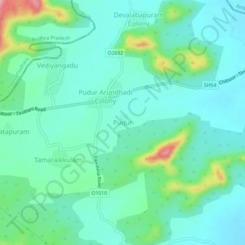
Name: Pudur topographic map, elevation, terrain.

Location: Pudur, Pallipattu, Thiruvallur District, Tamil Nadu, India (13.08161 79.30968 13.12161 79.34968)

Average elevation: 709 ft

Minimum elevation: 591 ft

Maximum elevation: 1,119 ft

Gear up for your next adventure:

🥾Hiking Shoes - Durable and comfortable shoes for trail hiking
🔌Solar Panel Charger - Charge gear sustainably outdoors
🔋Rechargeable Batteries - Power up your outdoor devices
🔥Plasma Lighters - Windproof lighters that work in any weather condition
🔪Outdoor Multitools - Essential survival tools for gear repair and field use

As an Amazon Associate, this site earns from qualifying purchases at no extra cost to you.