Geolocate

Auke Bay topographic map

Click on the map to display elevation.

About this map

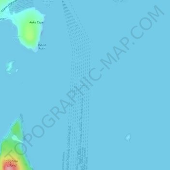
Name: Auke Bay topographic map, elevation, terrain.

Location: Auke Bay, Juneau, Alaska, United States (58.36745 -134.67783 58.36755 -134.67773)

Average elevation: 10 ft

Minimum elevation: -89 ft

Maximum elevation: 400 ft

Alaska trails, hiking, mountain biking, running and outdoor activities

Other topographic maps

Click on a map to view its topography, its elevation and its terrain.

Mendenhall Glacier

United States > Alaska > Juneau

Average elevation: 1,178 ft

Lemon Creek

United States > Alaska > Juneau

Average elevation: 1,414 ft

Lena Beach

United States > Alaska > Juneau > Lena Beach

Average elevation: 338 ft

West Juneau

United States > Alaska > Juneau

Average elevation: 361 ft

Gear up for your next adventure:

🧦Merino Wool Socks - Moisture-wicking, blister-preventing socks for long treks
🧥Men's Rain Shells - Premium waterproof and breathable jackets for mountain weather
🧭Orienteering Set - Complete compass and map reading kit
🪶Multi‑Purpose Knife - Useful blade for camp and trail
🛠️Backpacking Tool Kit - Essential toolkit for outdoor repairs

As an Amazon Associate, this site earns from qualifying purchases at no extra cost to you.