
Veľký Klíž topographic map
Interactive map
Click on the map to display elevation.
About this map
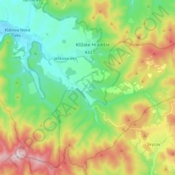
Name: Veľký Klíž topographic map, elevation, terrain.
Average elevation: 1,257 ft
Minimum elevation: 640 ft
Maximum elevation: 2,372 ft
The municipality lies at an altitude of 250 metres and covers an area of 42.405 km2. It has a population of about 916 people.
Other topographic maps
Click on a map to view its topography, its elevation and its terrain.
Partizánske
Slovakia > Region of Trenčín > District of Partizánske
Partizánske, District of Partizánske, Region of Trenčín, Western Slovakia, Slovakia
Average elevation: 784 ft