
Partizánske topographic map
Interactive map
Click on the map to display elevation.
About this map
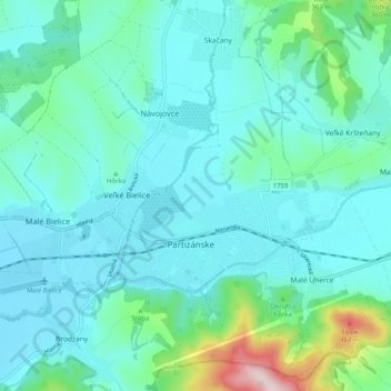
Name: Partizánske topographic map, elevation, terrain.
Average elevation: 784 ft
Minimum elevation: 594 ft
Maximum elevation: 1,775 ft
Other topographic maps
Click on a map to view its topography, its elevation and its terrain.
Veľký Klíž
Slovakia > Region of Trenčín > District of Partizánske
Veľký Klíž, District of Partizánske, Region of Trenčín, Western Slovakia, 958 45, Slovakia
Average elevation: 1,257 ft