Geolocate

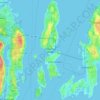
Fort Wetherill topographic map

Click on the map to display elevation.

About this map

Name: Fort Wetherill topographic map, elevation, terrain.

Location: Fort Wetherill, Jamestown, Newport County, Rhode Island, 02840, United States (41.47750 -71.35821 41.47760 -71.35811)

Average elevation: 13 ft

Minimum elevation: -7 ft

Maximum elevation: 98 ft

Other topographic maps

Click on a map to view its topography, its elevation and its terrain.
Gear up for your next adventure:

🧴Hand Sanitizer - Keep hands clean while hiking
👖Convertible Hiking Pants - Versatile zip-off pants for changing altitudes and temperatures
📱Solar Portable Charger - Solar power bank for charging devices off‑grid
🎁Geography Themed Gifts - Unique gift ideas for map lovers and geography enthusiasts
📚USA Hiking Guide Books - Top trail guides and map books

As an Amazon Associate, this site earns from qualifying purchases at no extra cost to you.