Geolocate

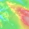
Belleville topographic map

Click on the map to display elevation.

About this map

Name: Belleville topographic map, elevation, terrain.

Location: Belleville, Ville de Woodstock, Comté de Carleton, Nouveau-Brunswick, Canada (46.13313 -67.78175 46.22760 -67.69264)

Average elevation: 449 ft

Minimum elevation: 151 ft

Maximum elevation: 863 ft

Other topographic maps

Click on a map to view its topography, its elevation and its terrain.
Gear up for your next adventure:

👟Men's Trail Runners - Lightweight footwear for fast-paced exploration and light hiking
🎒Trail Energy Bars - High‑calorie bars for hiking energy
🎒Hydration Pack - Hands‑free water reservoir for long hikes
🌲Outdoor Survival Books - Best books on survival skills
🚗GPS Dash Cams - Record your scenic drives through mountain passes and canyons

As an Amazon Associate, this site earns from qualifying purchases at no extra cost to you.