Geolocate

Straiton topographic map

Click on the map to display elevation.

About this map
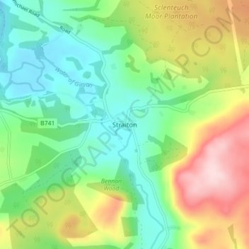
Name: Straiton topographic map, elevation, terrain.

Location: Straiton, South Ayrshire, Scotland, KA19 7NF, United Kingdom (55.29145 -4.57206 55.33145 -4.53206)

Average elevation: 610 ft

Minimum elevation: 308 ft

Maximum elevation: 1,148 ft

Gear up for your next adventure:

📚Navigation Handbooks - Master the art of reading topographic maps and using a compass
🏔️Mountain Trail Maps - High‑detail maps for popular peaks
☀️Outdoor Sunscreen - High protection sunscreen for outdoor activities
❄️Traction Cleats - Prevent slips on icy trails during winter hikes
🔦Compact Flashlight - Reliable flashlight for emergencies

As an Amazon Associate, this site earns from qualifying purchases at no extra cost to you.